Geologically speaking, the Baraboo Area rocks
Baraboo Area is home to ancient mountains and more
By Julie Ruffolo
Let’s start with the oldest rock – the bedrock. The start of the Baraboo Hills was created about 1.5 billion years ago when sand and other sediments accumulated along a prehistoric beach. Over millions of years, that sand was pressed into sandstone and further compressed and heated until the sand transformed into one of the oldest types of rocks visible in the Midwest – Baraboo Quartzite.
Then tectonic forces folded and uplifted these rocks, creating a mountain range that is even older than the Appalachian Mountains. Distinct fault lines that have been recently mapped by University of Wisconsin scientists help explain the way these mountains were created during this period of movement and compression. The Baraboo Hills today only rise about 500 feet above the surrounding area, that is because they are remnants from bigger mountains that have eroded over millennia.
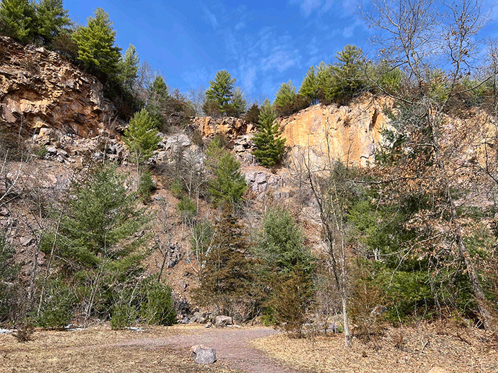
So today, we get to enjoy the colorful purple, pink and red quartzite cliffs throughout the Baraboo Hills area created over a billion years ago. The Baraboo Hills stretch about 25 miles east to west and vary between 5-10 miles wide north to south with the city of Baraboo roughly in the center.
In less than a minute, you can watch a University of WI Geological and Natural History Survey YouTube video that shows how the Baraboo Hills formed:
Then a Tropical Sea
Time travel a few hundred million years later and Wisconsin lay beneath a warm, shallow tropical sea. Roughly 500 million years ago, the Baraboo Hills became islands rising above these ancient seas, as thick layers of sandstone, shale and limestone were deposited. Waves crashed against the quartzite mountains and sediments accumulated around the edges which preserved an amazing record of environmental change and ancient marine life.
Many of Wisconsin’s fossils including trilobites, brachiopods, cephalopods and corals date from this time when the Badger State was covered with this tropical sea.
Ice Changes Much of the State
The most recent chapters in Wisconsin’s geologic history revolves around glaciers. Beginning about 2.5 million years ago, during the Ice Age, enormous sheets of ice covered much of the North American continent repeatedly – growing and retreating over and over which dramatically changed the landscape of the state. These glaciers carved lakes, flattened hills, deposited soil and created the flatter plains of most of the state.
Except the Driftless Area
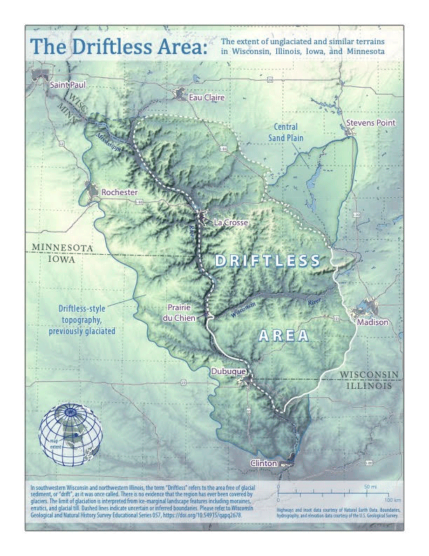
The word “drift” means the landscape formations left by a glacier as it moves. Much of these drift names are incorporated into places in Wisconsin – kettles, moraines, eskers, drumlins. But the southwestern part of the state was not covered by glaciers and thus became a unique area because the ice did not flatten everything.
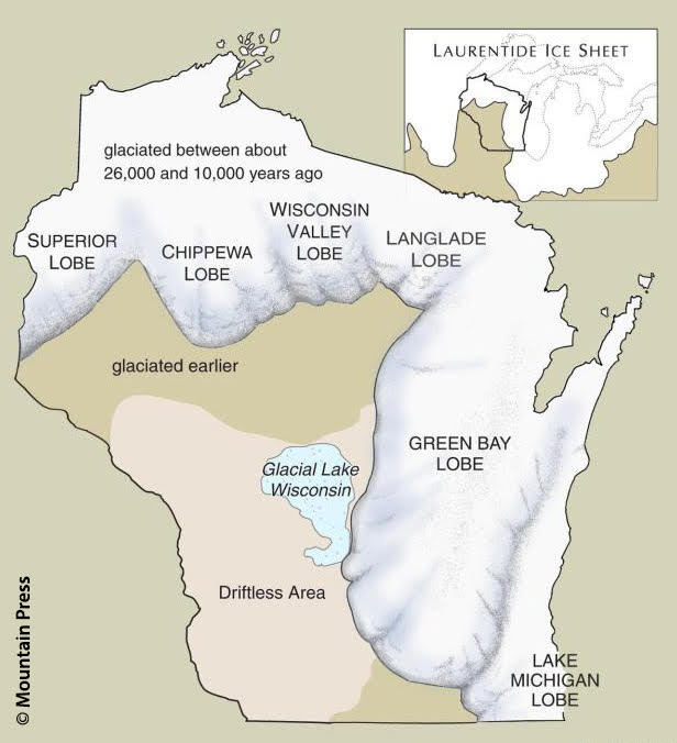
Sauk County is at the eastern end of the Driftless Area. Glaciers did impact the area, but not by covering and flattening the land, but rather as they melted. During the last ice age, about 18,000 to 14,000 years ago, a lake formed when the Green Bay Lobe of the Laurentide ice sheet (see diagram) grew right up to the eastern edge of the Baraboo Hills, essentially blocking the flow or damming the melting ice. This created an enormous freshwater lake that lasted thousands of years and spanned from about Wisconsin Rapids to Devil’s Lake. This lake created the sandy soil of the areas north of the Baraboo Hills.
Once the Green Bay lobe of the glacier melted, the dam was breached and the lake drained in weeks, cutting canyons as the water found its way south and west toward the Mississippi River. The Baraboo Area along with the rest of southwest Wisconsin and parts of northern Illinois, eastern Iowa and southeast Minnesota includes deep river valleys, steep wooded ridges, narrow sandstone gorges, spring-fed trout streams, dramatic rock outcroppings, thin rocky soils and an amazing biological diversity.
Sauk County is unique
Few counties in Wisconsin combine so many remarkable geologic features –
- The ancient Baraboo Hills, one of North America’s oldest exposed mountain ranges
- Sandstone bluffs and cliffs
- Exposed Baraboo quartzite dating back 1.5 billion years
- The Baraboo and Wisconsin Rivers carving dramatic valleys through resistant rock
- Glaciated terrain immediately next to landscapes untouched by the last ice sheets
Few places illustrate Wisconsin’s geologic history so clearly!
A geologic theme park – Devil’s Lake
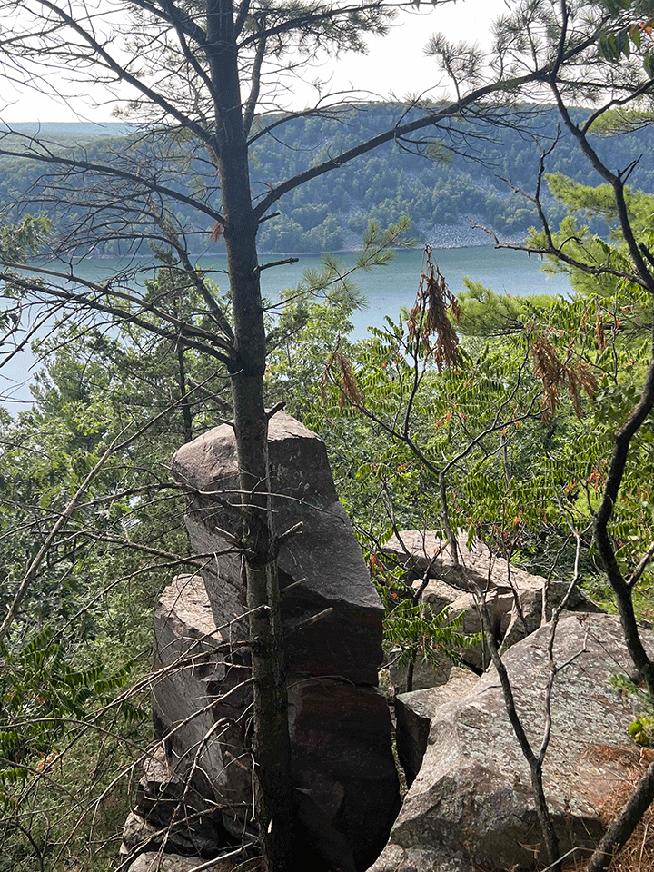
Likely the most dramatic and illustrative of the spectacular geology of the Baraboo Area is Devil’s Lake and the surrounding hiking area in the state park. The lake was formed between two towering quartzite ridges. Glaciers stopped their westward expansion at the Baraboo Hills and glacial deposits, and sediment blocked the valley and formed Devil’s Lake. It’s an amazing landscape and does not look like it belongs in Wisconsin! Find 500-foot quartzite cliffs, massive slopes of broken boulders and ancient rocks over 1.5 billion years old as well as a beautiful clear lake. There are countless sweeping views and recreational opportunities along with the incredible geologic formations.
Wisconsin’s first State Natural Area – Parfrey’s Glen
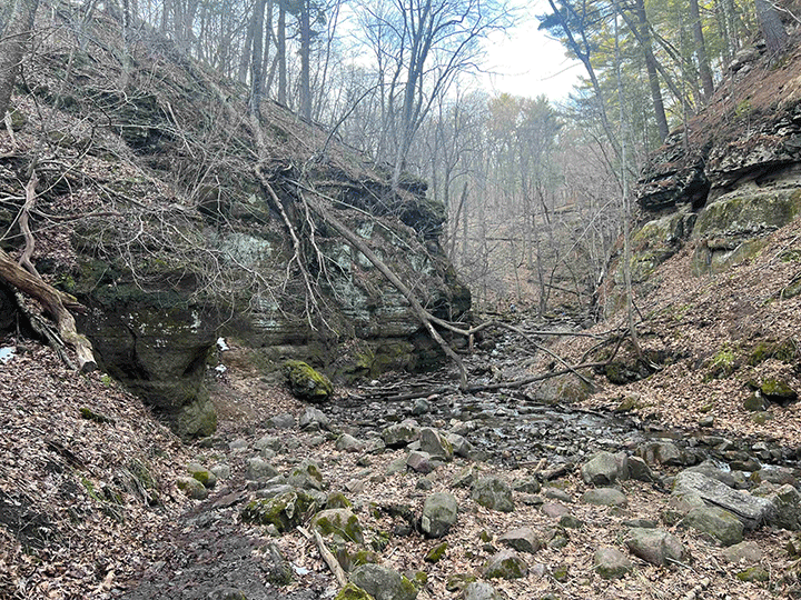
Glen is a Scottish word for narrow, rocky ravine – which describes this natural area accurately. A small stream has carved a narrow sandstone gorge, and the hiking trail follows the water through various landscapes. Look for exposed rock layers, waterfalls, plunge pools and shaded cliff faces. There is active stream erosion still going on today, so it’s a changing landscape subtly throughout the year with occasional flooding events that dramatically alter the gorge. There are unique exposed rock walls that show sandstone embedded with rounded quartzite pebbles, evidence of an ancient sea where these layers were added to the sediment at the bottom of the water as well as the shoreline.
An outdoor classroom – Ableman’s Gorge
Nowhere else in the Midwest is structural geology more evident. Carved by the Baraboo River that neatly bisects much of the Baraboo Hills, Ableman’s Gorge cuts through the resistant Baraboo Quartzite, exposing some of the best examples of Precambrian rock in Wisconsin. The nearby railroad tracks and quarry expose even more of the geologic cross-sections for study. The 200-foot-high bluffs follow the river for about a mile, and the rock formations are world renowned. Ableman’s Gorge forms the Upper Narrows of the Baraboo Hills with the corresponding Lower Narrows further downstream of the Baraboo River just before its confluence with the Wisconsin River, east of the city of Baraboo on Highway 33.
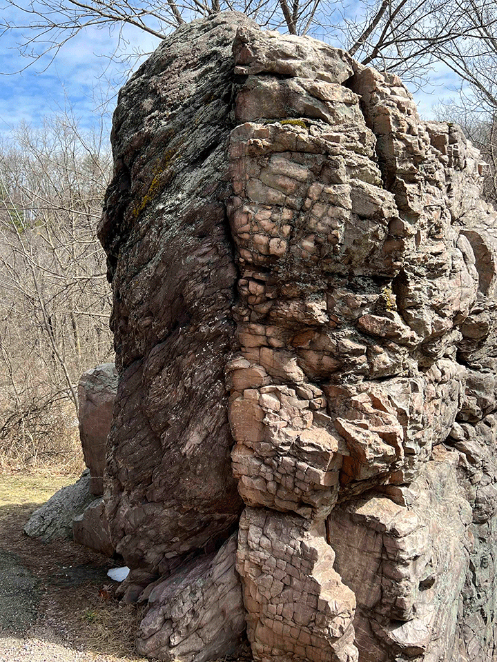
Don’t miss Van Hise Rock, across Highway 136 from Ableman’s Gorge. The rock is named in honor of Charles Van Hise, a UW professor and chair of the Department of Mineralogy and Geology who studied the area extensively. This monolith illustrates the features of folding in the Earth’s crust that explains mountain building that occurred about 1.6 billion years ago.The rock is a National Historic Landmark and is still used in geological education and research.